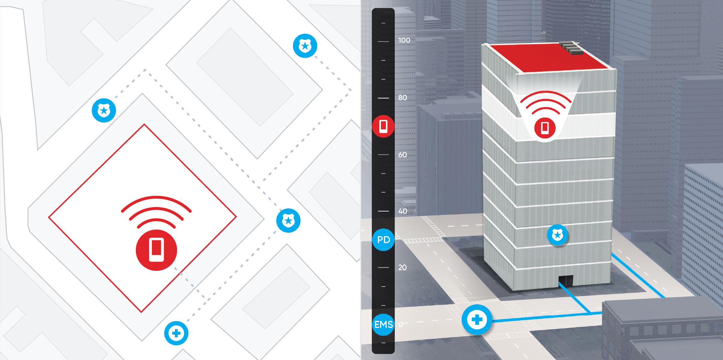
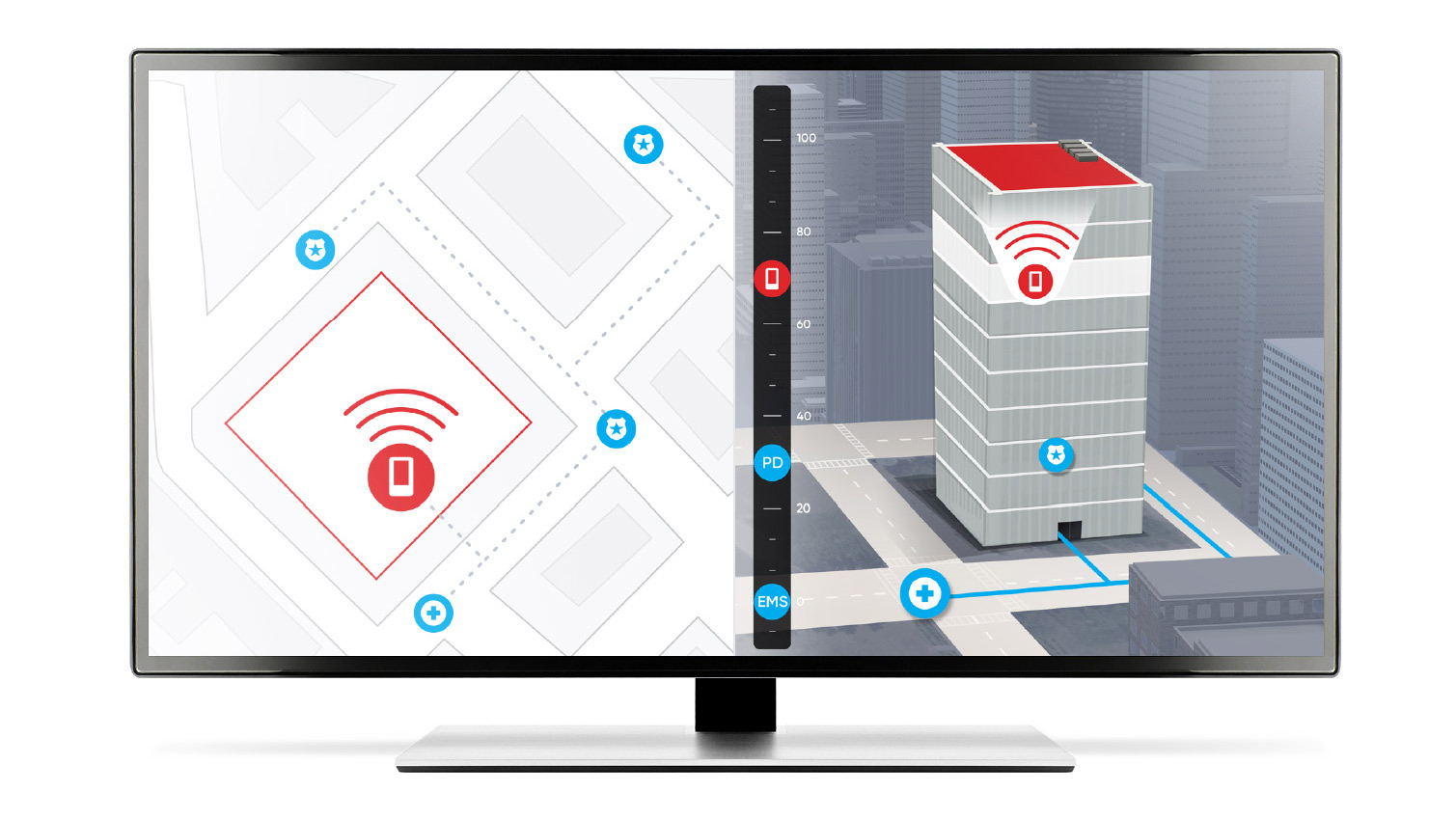
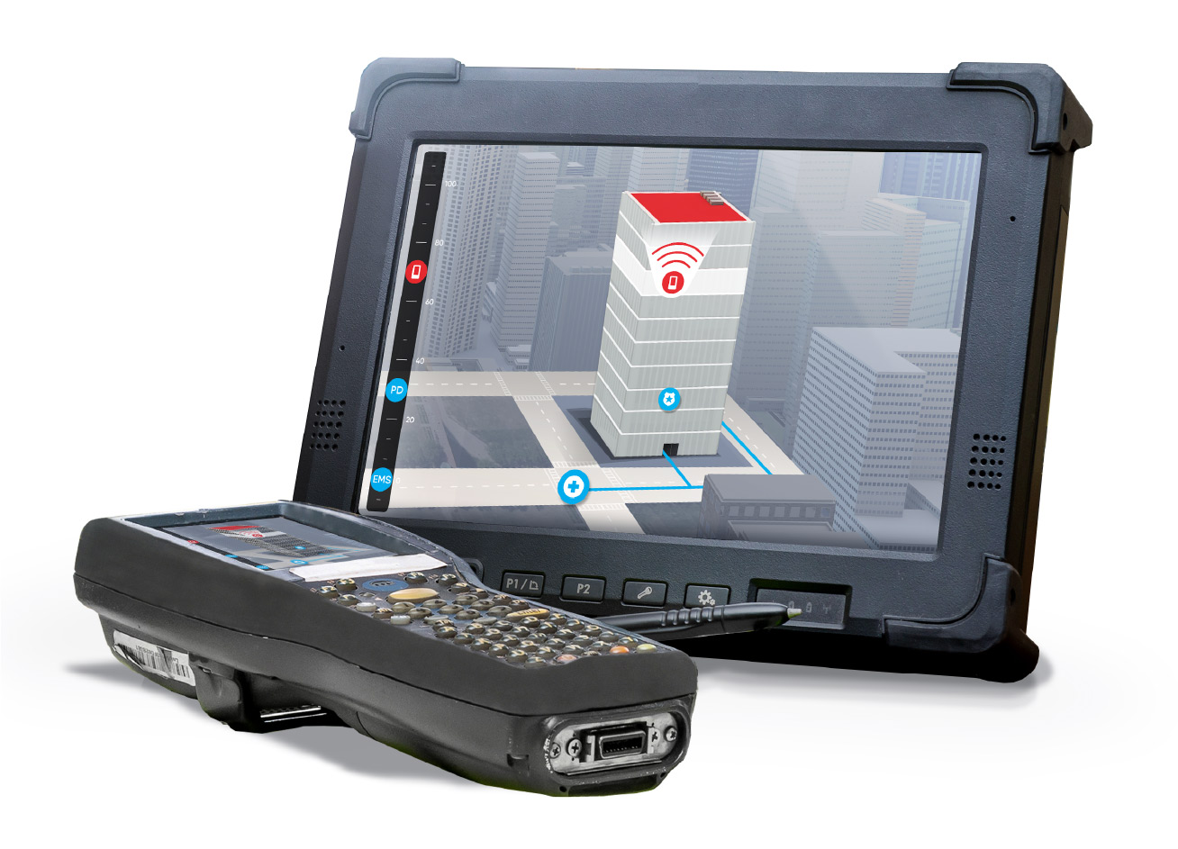
Public Safety

Altitude data takes first responder safety and
situational awareness to new heights

Track first
responders with floor-level
precision

EMS responding to victims in a parking garage.
Law enforcement responding to an active shooter in a high rise.
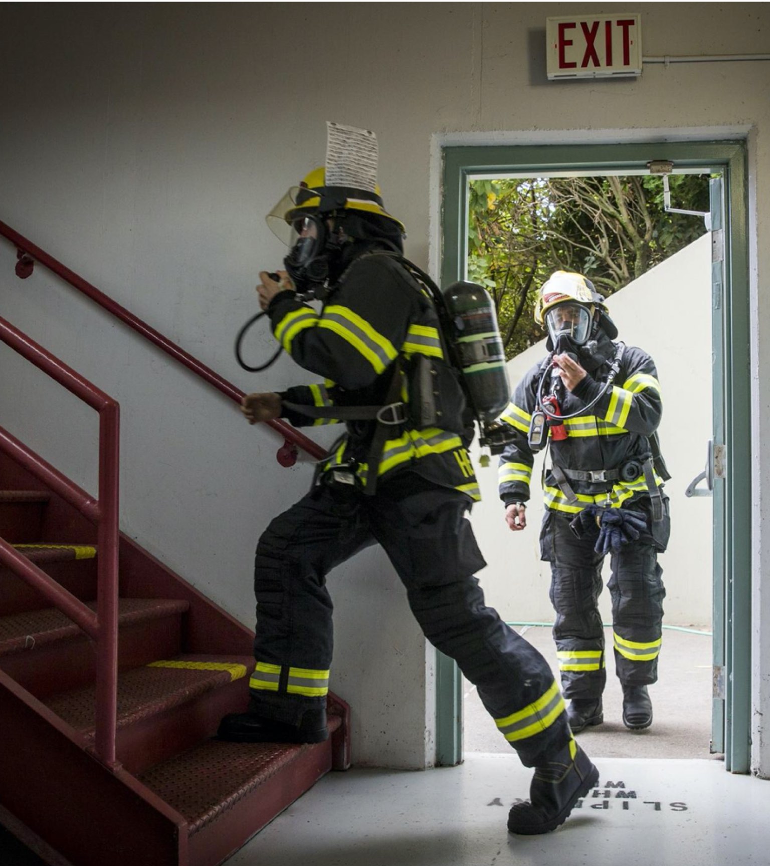
Firefighters in a smoke-filled building.

When every second counts, precision matters. NextNav’s Pinnacle vertical positioning technology provides situational awareness, designed for first responder and blue force tracking. Pinnacle provides reliable, accurate floor-level location data that helps incident commanders keep first responders safe—and find victims faster.

Faster response
times save lives

  • 70%

    70%

    70% of first responders report that the maps and navigation databases they use have missing or inaccurate information

  • 80%

    80%

    More than 80% of 911 callers are on cell phones

Vertical position data delivers 3D situational awareness for incident commanders

First responders often work in indoor or multi-story locations where GPS location is unavailable or inaccurate. Incident commanders who rely on GPS tracking devices to monitor first responders can find themselves “going in blind” in dangerous, complex situations.

Voice communications and “man down” detection are insufficient solutions for real-time situational awareness which allows incident commanders to understand the physical context of the scene through visualizations.

NextNav’s Pinnacle gets geolocation data from a dedicated terrestrial network designed for reliable operation in urban environments. By adding altitude information to latitude and longitude coordinates, incident commanders can track first responders right down to the floor they are on, allowing more informed, real-time decisions that help keep first responders safe even in dangerous or hostile locations.

Orchestrate more effective response strategies

Orchestrate more effective response strategies

The ability to monitor first responders as they move across floors also helps you coordinate actions to:

  • Direct safest avenues of approach
  • Get to victims faster
  • Know where fire hydrants and exit doors are

Integrating Z-axis to Emergency Services Systems

NextNav Pinnacle provides the precise, z-axis that public safety officials have called the “holy grail”. and has been selected by a top nationwide wireless carrier to provide vertical location for 911. The system provides for faster response times to save more lives and independently proven to offer ±3m accuracy 94% of the time, exceeding FCC requirements.

  • Caller Location

    + Vertical Height

  • Ingress

    Incoming 911 calls

  • Egress

    Location data to Public Safety

  • Device Integration

    Dispatch and First Responder Apps

Managing incoming 911 calls

Lorem ipsum dolor sit amet, consectetur adipiscing elit. Praesent leo lacus, consequat at consectetur ac, interdum sed eros. In fermentum nunc a luctus egestas. Pellentesque dignissim nisl et leo tempor lobortis. Aliquam condimentum augue id nunc efficitur imperdiet. Nulla sed nulla eget diam facilisis finibus. Proin et libero condimentum, sodales mauris vitae.

Dispatch (2D and 3D visualization)

Sedut adipiscing ornare risus. Morbi est est, blandit sit amet, sagittis vel, euismod vel, velit. Pellentesque egestas sem. Suspendisse commodo ullamcorper magna.

Pinnacle features

Z-axis data with +/- 3 meter accuracy

Add altitude awareness to latitude and longitude data for more precise tracking of people and assets

Dedicated altitude network

Precisely surveyed, high density network that delivers “floor level”, real time altitude data nationwide

Network maintained by NextNav

Altitude data provided by a proprietary network built for public safety and operated and maintained by NextNav for high availability

Metro-wide coverage

Consistent z-axis geolocation capabilities available throughout large urban markets; no need for building-specific infrastructure

Works with most existing and new devices

Available through a simple software upgrade to devices with barometric pressure sensors

Simple SDK integration

Easy-to-use SDK makes it easy to integrate 3D geolocation technology into existing applications

Partners

Add vertical location
data to your app

NextNav licenses SDKs and API calls to its vertical location service so developers can easily incorporate this powerful new data stream into applications.

NextNav Pinnacle service for vertical location now available in sixteen major US markets

Read Story

Stay in touch

Keep up to date on the latest news, events,
promotions and more from NextNav.